
This walk starts at Brixton Underground Station and ends at Crystal Palace Bus or National Rail Station. The route goes via Brockwell Park, Ruskin Park, Dulwich Village, Dulwich Park, Sydenham Hill Wood Nature Reserve, Dulwich Woods, Sydenham Wells Park and Crystal Palace Park.
This is an easy walk of 10.05 miles (16.18km), but with plenty of drop-out points should you wish to tackle it in short stages. It visits a number of South London’s most attractive parks, together with a good woodland stretch, and ends at the historic Crystal Palace site. The route tries to minimise road walking, but most of the route is still hard-surfaced; however, the wooded section can be quite muddy.
1. Turn left out of Brixton Tube Station and cross Electric Avenue; its unusual name derives from being the first market street to be lit by that medium. Further on, cross the end of Coldharbour Lane, and continue forward across Windrush Square with the Tate Library on your left and Lambeth Town Hall, built 1906-08, over to the right. Cross Saltoun Road and continue ahead along Effra Road.
Windrush Square was created to commemorate the 50th anniversary of the arrival of the ship, Empire Windrush in 1948, on which sailed some of the first Caribbean immigrants to arrive in Britain. St Matthew’s Church across the road is one of four “Waterloo” churches built in the borough in 1822, using public money voted by Parliament; the other churches are St John (Waterloo), St Luke (West Norwood) and St Mark (Kennington).
2. Continue along Effra Road for another 550 metres until Brixton Water Lane is reached, with the Hootananny pub on the corner. Turn left here along the right-hand pavement, cross Arlingford Road and, 50 metres further on, enter Brockwell Park through a gate.
3. Take the forward path, keeping close to the backs of houses. Towards the top of the rise, fork right to go past a children’s playground and, at the junction after, turn left to keep close to the back of flats on the right. Go over the next cross-path then, in 20 metres, turn left on a path between railings to cross a bridge. Now follow railings on the right. These hide dense foliage, behind which are a series of small lakes. Continue straight on, ignoring a side path on the right. Coming into the open, continue between a pond and a wall with climbing plants, soon skirting a walled garden to your left. At the corner, swing around left by the remains of a model village to enter this secluded garden, with its clipped yew hedges and formal paths, before returning to the entrance.

Brockwell Park walled garden
4. Now continue in the same direction as before, walking uphill to more gardens. Ignore the first path on the left but, in another 25 metres, turn left on the cross-path to pass to the right of an ornamental clock, known as Little Ben. Redevelopment work is currently taking place around Brockwell Hall so, at present, it is necessary to skirt to the right of the closed-off site. Once past the Hall (built in 1811-13), find a gradually descending path towards a railway bridge and road junction visible in the distance. As you descend on the path, a wide view of central London skyscrapers can be seen on the left. The spire in the middle distance ahead is that of St Paul’s Church, Herne Hill, built 1843-44, a favourite of John Ruskin, who lived in the parish.
5. Cross the road junction by the lights, bearing half-left to enter the pedestrianized portion of Railton Road - there is a Sunday market here. Go past Herne Hill Station and immediately take the passageway leading under the railway to Milkwood Road, which cross, to turn left on the opposite pavement. (Should the passageway under the railway be closed, walking forward under the railway bridge at the previous junction and taking the first left will bring you to the same point). The heavy railway wall on the left soon gives way to an open fence. Continue up Milkwood Road, cross Shardcroft Avenue then, as the road curves right, turn right into Gubyon Avenue and, in another 25 metres, left into Fawnbrake Avenue. Follow this pleasant tree-lined street for 500 metres, cross Poplar Walk into Ferndene Road, crossing Herne Hill Road at the end. The imposing building on the corner of Herne Hill Road is the Carnegie Library, built in 1904.
Drop-out point: The P4 bus runs along this road should you want to return to Brixton from here.
6. Continue along Ferndene Road opposite and, in 25 metres, turn left into Ruskin Park. Keep to the path by the right-hand fence, next to the road with a field on the left. Continue forward past toilets and another gate until railings surrounding gardens are reached. Pass through the lower of two gates, turn left and then turn right through a brick-built walkway. The sunken area on your left was a former bowling green. At the end of the walkway, turn left down steps, then keep to the left of a pond. The large building ahead is part of King’s College Hospital, with a helicopter pad for emergency flights on its roof. Swing around the end of the pond and continue forward, with an evergreen hedge on your left. On reaching a cross-path, turn right to take a path up (or around) steps. The gardens of eight of the houses on Denmark Hill were incorporated into the park and the portico of No 170, built in 1799, which we pass, still stands. Continue on, to leave the park by the next gate on the left.
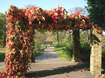
Ruskin Park Pergola
7. Carefully cross the busy Denmark Hill. The road was originally named Dulwich Hill, but the name was changed in honour of Queen Anne’s husband, Prince George of Denmark, who lived locally. Pass through the carpark of the Fox on the Hill pub. Food and refreshments can be found here if needed. At the far end, turn right along Champion Hill. Old walls in front of new buildings testify to the substantial villas that were once here. A few still remain, but the area is now dominated by the halls of residence for King's College, some newly built. Continue over the crossroads at the top of the rise, then descend downhill, eventually taking a path into woodland. Turn right at the T-junction to enter Green Dale Fields. Follow the winding path and go through the gate at its end to emerge at a combined cycletrack/footpath (Green Dale).
8. Turn left here, eventually passing playing fields on both sides. This area is a quiet backwater now, and it seems hard to believe that no fewer than four V1 flying bombs landed in these fields in 1944-5, but fortunately with no fatalities. As Green Dale changes into a road, note the coats of arms on the railway bridge, together with the initials “AC” and the date, 1866. The arms are those of Alleyn’s College and the London, Brighton and South Coast Railway. Continue for another 100 metres to reach East Dulwich Grove.
Drop-out point: East Dulwich Grove is served by the 37 bus route which will take you back to Brixton if you feel you have walked enough.
9. Cross East Dulwich Grove at the lights to enter Townley Road, then veer right into Calton Avenue after 50 metres. After more playing fields on the left, comes the church of St Barnabas, built in 1996 to replace its Victorian predecessor destroyed by fire. The spire, unusually, is made of glass. Continue forward to the main crossroads in Dulwich Village. Here, at the corner of the old graveyard, remnants of the village stocks can be seen. The graveyard dates from 1616, has attractive wrought-iron gates, and contains the Dulwich victims of the Great Plague. It was formally closed in 1856, although a few sporadic burials were made since. From here, turn left along Dulwich Village itself.
Drop-out point: There is another chance to return to Brixton here via the P4 bus route.
10. Fine 18th century houses line the left side of the road, in contrast with the smaller and newer ones on the right. Shortly pass a splendid Victorian pub, the Crown and Greyhound. There used to be two pubs here, the Crown, frequented by labourers, and the Greyhound across the road, favoured by the more well-to-do. The Greyhound has now disappeared and the Crown was rebuilt c1895 as the Crown and Greyhound. Look up to see the elaborate decoration and a floral display. A small traffic roundabout is reached - attractive with its granite drinking fountain, finger post and shrubs. The small spiky white building diagonally opposite is the Old Grammar School, whilst immediately forward are the original buildings and chapel of Dulwich College, now Edward Alleyn House. Edward Alleyn founded Dulwich College in 1619 and the Estate still owns much of the land hereabouts.
11. Continue on the left-hand pavement, past the former bank and, in another 100 metres, turn left through Old College Gate into Dulwich Park. Art lovers might want to visit Dulwich Picture Gallery first, however. The entrance to this is by the low brick building on the opposite side of the road, just past the Old College Chapel. This is Britain’s oldest purpose-built art gallery (admission charge). The collection was originally put together in 1790-95 for the King of Poland, but when he was forced to abdicate, the dealers, Noël Desanfans and Francis Bourgeois, had to find another home for the paintings. They were left to Dulwich College in 1811, and include works by Rembrandt, Rubens, Poussin, Murillo and Gainsborough.
12. The Grade II-listed Dulwich Park is a fine late-Victorian public park, opened in 1890, and formed from former grazing land known as the Five Fields. Some of the oaks in the park are old hedgerow trees dating from this time. Walk along the Carriage Drive and pass to the right of the traffic barrier. After 50 metres, look for a short section of path on the left across a sanded horse-ride. Go up here, then turn right by the railings to cross a bridge and follow a lake on the left, which supports a variety of wildfowl. On reaching a railed boardwalk over the lake, turn left over it. At its end, cross over a path to go forward, swinging right past rhododendrons to emerge at a T-junction. Note the line of fine old oak trees, which pre-date the park by years. Turn left here to find toilets and the park café.

Dulwich Park
13. Otherwise, turn right at the toilets, then almost immediately left on a broad path. In 40 metres, turn right on a cross-path, passing a bowling green on the left and a playground on the right. Go straight over the next cross-path to take a left-handed curve with benches, passing through the American Garden, which boasts a superb display of rhododendrons and azaleas in late Spring. Where the path divides at a wooden shelter, swing right, then shortly left, to cross the sanded horse-ride again and exit the park through the Rosebery Gate to the left. Now turn left along Dulwich Common, part of the South Circular Road. We need to cross this busy road and the safest place to do so is via the traffic island refuge a short distance further on.
Drop-out point: Again, the P4 bus can take you back to Brixton from here if desired.
14. On reaching the road junction after 350 metres, enter Cox’s Walk, just before the lights. The church now on your left was formerly dedicated to St Peter and was built between 1873-74. It has seen better days, but is surprisingly spacious inside. Follow the well-surfaced path for 570 metres uphill to find a bridge on the left spanning an abandoned railway line, built to serve the newly-erected Crystal Palace, and it was from here in 1871 that the impressionist painter, Camille Pissarro, executed his painting of a train leaving Lordship Lane Station. The painting now hangs in the Coultauld Institute Gallery. Unfortunately, this bridge is now unsafe, so go forward through the gate, soon bearing left on a made footpath with fences each side. We pass a series of marker posts for the Green Chain Walk (GCW), a 50-mile (80km) network of public footpaths spread throughout five London boroughs. After 100 metres, turn left down steps, then right, onto the trackbed of the former railway and continue to follow the GCW marker posts for a further 240 metres, ignoring a sand-coloured footpath on the left. Go past the first set of steps on the right but proceed to a cross-path a few steps further on.
15. There are now a couple of diversions you might want to take before continuing on the main walk. Continuing for a few metres forward on the trackbed will take you to the impressive (now closed) portal of the tunnel which took the railway to Crystal Palace High Level Station. Alternatively, turning left will take you into London Wildlife's Trust's Sydenham Hill Wood Nature Reserve, where a numbered nature trail can be followed, and which passes a mock ruin - a "folly" dating from Victorian times.

Snow scene at Sydenham Hill Folly
Drop-out point: Turning right here will bring you to College Road, with Sydenham Hill National Rail Station directly opposite, from where trains connect to Brixton and Victoria.
17. Turn left steeply uphill on Low Cross Wood Lane. At the top of this, detour left for a few metres along Crescent Wood Road to view No 3, where lived John Logie Baird, the inventor of television. A little further along, across the road, is Six Pillars, an important modernist house. Retrace your steps and pass the Wood House pub, then cross the busy Sydenham Hill via the pedestrian crossing and enter Wells Park Road opposite.
Recommended pub: The Wood House, owned by Young’s, feels more like a comfortable house than a pub, and was indeed originally the home of Sir Joseph Paxton, the designer of the Crystal Palace. Real ale and food are available and there is an extensive garden.
Drop-out point: The 202 bus route runs along Wells Park Road and connects to the end point of the walk at Crystal Palace Parade.
18. Follow the gently curving Wells Park Road downhill. Look for a gate in railings on the right between a wooded area and No 159, which was formerly Upper Sydenham Station. If you want to see the other end of the railway tunnel whose acquaintance you first made in Sydenham Hill Wood, descend on the path here before returning to Wells Park Road and continue downhill. In another 100 metres, cross Longton Avenue and turn right into Sydenham Wells Park. The park is the remnant of Sydenham Common and medicinal wells were discovered here around 1640, but not developed until the early 19th century. Take the right fork and descend into the bowl of the park, ignoring all cross-paths. Pass a lawn with palm trees and descend to a lake on the left. Now take the curved rising path on the right to leave the park. Cross Longton Avenue (again), go up Ormanton Road, and cross the busy Westwood Hill. Go forward into Charleville Circus, bearing either left or right around the circle of houses, then along the remainder of the street to emerge onto Crystal Palace Park Road. Turn left downhill here for 100 metres and enter Crystal Palace Park via Fisherman’s Gate on the opposite side of the road.
19. Turn left after 25 metres and, towards the bottom of the hill, where the surface changes, turn left on a side path. Go over the next cross-path, near a car-park, and continue all the way down to a second car-park. The buildings now on your right contain an information centre and toilets. On the small hill ahead is the new café. (NB: Cards, but not cash, accepted!) Go up left of this to reach Dinosaur Lake and the start of the Prehistoric Monster Trail. Here turn right to keep the lake on your left. Look out for a group of Irish Elks and turn left here, continuing to turn left at all succeeding junctions.

Dinosaur, Crystal Palace Park
20. Cross the bridge by the replicated geological strata and bear left at the fine Penge Oak, which marked the county boundary between Kent and Surrey before London expanded. We now explore the main group of dinosaurs. The thirty-three life-sized creatures were created in 1854 by Benjamin Waterhouse Hawkins under the direction of Professor D T Ansted. Research since that date has revealed that at least some of them are now known to be anatomically incorrect. Comprehensive information about the display can be found at www.cpdinosaurs.org
21. At the far end of the lake, turn right to ascend the hill to the flat-roofed Crystal Palace Park Centre (now run by Capel Manor College). Continue round to the right to keep the National Sports Centre on your left. Twenty-five metres before the gates (near the far end of the stadium), turn right on a downhill path. At the bottom, turn left on the cross-path, go past a picnic area, then straight over another cross-path. Pass swings on the right, to eventually arrive back at a path where you were earlier. Turn left here and, at the top of a short hill, turn left in front of the somewhat-hidden Fishing Lake. Go around a series of bends and, where the path becomes more open, look for The Maze on the left. This is a recreation of one of the park’s most famous features, originally created around 1870 and now restored. Explore at will before returning to the main path.
22. Now go past the Concert Bowl bandstand. Ignore the paths in front of the first of the terraces, but continue forward to turn left through gates at the top of the hill, then swing right to gain the uppermost terrace, at the top swinging left past monumental sphinxes. There are huge views south-eastwards towards rural Kent, and on your right is the BBC’s Transmitter Mast, at 219 metres, once the tallest structure in Greater London.
The Crystal Palace opened in Hyde Park in 1851 to contain the Exhibition of the Industry of All Nations. It was moved to its new site in Sydenham in 1854, where it remained until destroyed by fire in 1936. Apart from the terraces, there is little now that remains of the palace itself, but the gigantic base of Brunel’s South Water Tower, together with some hydraulic pipework, can be seen by the museum. Crystal Palace Park has a long connection with sport; earlier in the walk you passed the National Sports Centre, the FA Cup Final was held in the park between 1895-1914, and there was a famous motor racing circuit in use between 1937-72.
23. Follow the terrace until a wide set of steps comes in from the left. Take the ramped path on the right, then continue on to reach the Crystal Palace Museum. Currently only open for a few hours on Sundays, admission is free. The museum is housed in the only surviving building constructed by the Crystal Palace Company about 1880.
24. The walk finishes here. For a bus connection back to Brixton (Route 3), climb further steps and pass through a formal garden to find the bus station ahead of you. Or, to connect with central London by rail, turn left downhill, exit the park right, cross the National Sports Centre approach road, then take the minor road to find Crystal Palace Station ahead.
© Mike Biggs, Ramblers (Inner London Area), 2023
If you have any comments about this walk, or notice that it needs updating to take account of changes on the route, then please contact Mike at